
When Guides Are Not Enough (and Why I Had to Return to the Dolomites)
There is a particular kind of frustration you only recognize when you travel with the ambition of truly understanding a place: arriving at a long-dreamed destination, confident after years of experience, and realizing that your system no longer works.
After entire summers of trekking in Patagonia, I had developed a solid, reliable method. Map studied, refuge selected, parking spots or buses identified, return time agreed upon, packed lunch and snacks ready. Without ever planning it, I had become a trekker. When I finally had the chance to experience the Dolomites, I knew it wouldn’t be so easy to apply the same framework. And yet, the iconic jagged peaks made one thing immediately clear: every mountain range has its own language — and I didn’t speak this one yet.
So how did I try to plan the trip? First, I turned to friends who were already regulars in the region. They advised me on where, among the countless villages, it made sense to base myself, and which mountain huts were worth visiting.
Then I bought a digital guide — which soon became two — both promising to give me everything I needed. I found beautiful photographs, hotel suggestions (I chose mine from there, an excellent recommendation), lists of villages, and a suggested seven-day circuit through the area. Despite actively searching for information, I left without really knowing what I would be walking — but with confidence.
When I finally arrived in Castelrotto, I was surprised. I expected to choose a trail, walk all day, and return exhausted. Instead, I encountered an entirely different system:
- Villages at every altitude
- Accommodation within the plateaus
- Mountain huts accessible by car or cable car
- Trattoria-style food in the middle of the mountains — a very welcome discovery
What no one had explained to me was this: the Dolomites are not a mountain chain in the classical sense, nor do they resemble the rest of the Alps. They are a constellation of isolated massifs, made of dolomitic rock, surrounded by an intricate network of valleys — many of them crossed by roads and connected through mountain passes.

In practice, the plateaus are vast green high-altitude valleys, traced by mostly flat paths, dotted with beautiful hotels and meadows inhabited by cows, sheep, and horses. A concrete example: Compatsch (1,844 m), the gateway to Alpe di Siusi. You arrive by car or cable car. From there, you can start walking… or take a carriage ride, or cycle. A nearly democratic form of access to altitude, offering extraordinary views without extreme physical effort — sometimes even from your hotel pool.
The trip was unforgettable. And yet, something didn’t quite add up. Autumn fog concealed the sharp peaks, and I still didn’t fully understand the system. The green, reflective lakes were a pleasure, but something was missing.
Of course, I went back. This time during Christmas week, a classic Italian settimana bianca. I decided to focus on a smaller yet central area: Val Gardena. At a cable car station, I stopped in front of a topographic map mounted on the wall. I mentally traced each peak: Sassolungo, Sella, Langkofel. Then I stepped outside and searched for those same silhouettes from the viewpoint. Could I see them from here? Where did the trail go? In which direction was Bolzano? Perhaps a bit obsessive for my companion — but I made sure the information settled.
This process — observing, returning, building a system — is exactly what I do professionally. In Italy, Argentina, Patagonia, Mexico. I don’t assemble lists of must-see places and arrange them into days. I design a mental map to read a territory the way I read it myself. So that when you’re standing in Compatsch, looking at Sassolungo, you understand why that plateau exists, how it connects to the surrounding area, and what it reveals about Dolomitic geology.
There is something deeply counterintuitive about this. We live in a world where Google Maps tells us exactly how to get anywhere. Digital guides promise “everything you need.” YouTube offers step-by-step experiences so you can “live it” before you arrive. In that context, returning to a place simply to understand it better seems inefficient. But efficiency alone does not build understanding.
“Top ten” lists overwhelm us, hidden gems hide nothing anymore, and every corner of the planet has its guide. We are saturated with information, yet thirsty for comprehension.
Geographic logic, cultural rhythms, why one village sits higher than another — these details reveal themselves only with time, patience, and the humility to admit that the first time, you didn’t understand much at all. Knowing where to go is not the same as understanding what you are seeing.

The Dolomites reminded me of this once again: every place has its own geographic, cultural, and linguistic system. Understanding its differences — and the reasons behind them — is part of my obsession.
Not every trip requires this level of depth. But the ones that matter do. If you are planning your honeymoon, that once-in-a-lifetime fortieth birthday, or the single month of the year when you truly disconnect — this is that kind of journey.
—
Sole
PS: If you’d like to explore the area further, this carousel highlights the most iconic peaks, valleys, and villages of Val Gardena, one of the Ladin valleys of the Dolomites. And if you’re planning a trip, you can book a 30-minute conversation here. We’ll talk about your destination, your dates, and whether it makes sense to design it together.

Want to receive my newsletter? Subscribe to "El Baùl Cultural" on my Substack!
A weekly space for reflection where I share my experiences, expressed through my passions: reading, travel, film, art, politics, and technology.
In northern Argentina, August is celebrated by feeding the earth. In Italy, by closing the office.
In five days I received two messages.
The first came from the road that links Salta and Jujuy. A friend riding shotgun, telling me she was taking the day off to celebrate the first of August, as one should. I confess I had to google it.
The second arrived in writing, from a design studio in Alba, Piemonte. They were happy: the holidays are coming. Ferragosto is near.
In northern Argentina, as in other Andean regions, this is the dry season, so on the first of August a hole is dug in some corner of the garden, the balcony, the mountain, and the family offers the earth what it likes best: empanadas, wine, coca leaves, a fizzy drink. The earth is fed. Thanks are given, prosperity and fertility are asked for, and the empanadas and wine pass on to the guests. The siku, played in pairs because each musician holds half the notes, the chacareras, rock or cumbia sound in the background, and it all turns into a party.
In Italy, around these dates, the opposite happens. The 15th of August has been celebrated since Roman times. The tradition comes from the Feriae Augusti, the rest after the labours of the field decreed by the emperor, which later absorbed a Christian tradition, the Assumption of the Virgin. Over there it’s hot and everything is closed. If you’re in the city, you’re probably a foreigner. It’s not the earth that eats and drinks, but the Italians. Saying Buon Ferragosto is a way of closing the office, greeting the family and taking the train to leave the concrete behind.
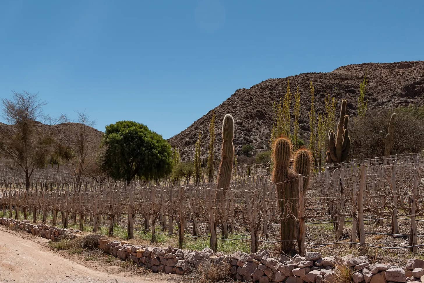
Something else is done in Argentina at this time of year, in the Litoral mostly, though it has spread a little to the rest of the country: drinking caña con ruda. Last Sunday was the first Vino de Viaje gathering, where we drank not caña but wine. One of the wines was from Jujuy, from the Quebrada de Humahuaca, a desert around the Río Grande. It’s hard to imagine vineyards there, among hills of seven and fourteen colours and cardón cacti several metres tall. But thirst suits the vine: less water, smaller bunches, each grape more concentrated. And the high-altitude radiation thickens its skin.
In Piemonte, between the Ligurian Sea and the Alps, the August heat has an expiry date: by October you can’t see the vineyard next door. That’s where Nebbiolo is harvested, a grape named after the fog and pale all the same: little colour, plenty of tannin.
The desert where you can see everything gives an opaque wine. The fog where you can see nothing gives a transparent one.
Besides the wine, I told them how to travel to each bottle: where the Dupont estate sits in Maimará, what you cross on the road, where to stop. And we talked about the pasacana, the cardón’s fruit, with those white hairs. I didn’t tell the legend: a cacique’s daughter who fled with a forbidden love, and Pachamama, who sheltered them by turning them into what they are now. She stayed there, embracing him, under the green poncho.
My friend has already toasted the earth and is driving back along that road. In Alba they’re closing the studio. The cardones are still there, standing in the desert.
Originally published in The Detour on 10 August 2026.
A cash-only ferry, an accidental detour, and a full-scale replica 8,000 kilometres away.
When I told my mother I was going to the Alps, she said not to miss Hallstatt. It was the place she had loved most on her trip fifteen years earlier. She warned me it wasn’t easy to get to, that she had gone with a tour. Stubborn as I am, I decided not to.
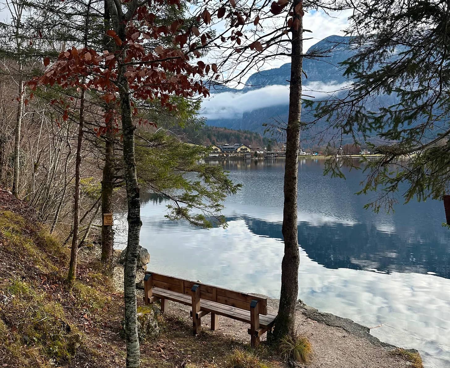
With the help of Google and AI, I optimised the perfect route from Salzburg. Hallstatt sits across a lake from its own train station, and you can reach it by road, driving straight in, or by a combination of transport. I chose the complicated one: a scenic bus skirting the great Wolfgangsee, a few stops on a local train and, finally, a short boat ride that crosses the Hallstätter See in a perfect straight line to arrive at the prettiest village in Austria, perhaps in all the Alps.
But the optimisation failed. As the crowd came off the train and began to pile up on the pier, I overheard, in someone else’s conversation, what was about to become my problem: only cash. And of course, I had none. With very little hope I waited for the boat to dock and asked about possible exceptions. The answer was a dry, simple no. I was stranded on the wrong side of the lake.
I looked along the left shore and spotted a path; according to the map, the next village was an hour away on foot. The alternative was to wait for another train, which would take just as long, or to turn back. It looked like a pleasant walk in the sun, so I set off along what seemed to be a bicycle path, rising and falling for a few kilometres beside the water.
When I reached Obertraun I found a village that was picturesque, but a ghost. From where the village began, with its little alpine houses and small uninhabited hotels, I walked another twenty minutes, starting to doubt a strategy that had brought me, on foot, to nowhere.
A few metres past the chapel stood the famous ATM. At the bus stop, a tidy timetable announced the next service in an hour. After a short, warm exchange with the woman at the tourism office, centred on the activities winter would soon bring with the snow, I went back out to wander until it was time. The absolute silence was broken by a bus returning children from school. While they got off and scattered, running to their houses, mine arrived.
Minutes later I was sitting with my nose against the glass to follow, up close, the route that climbed to the Krippenstein ski centre, on the Dachstein massif, and brought me, finally, to Hallstatt.
The first impression didn’t come from the village but from the number of people with suitcases, large and very large, moving in every direction. For me this was a day trip; it took me a while to understand what was happening. Since the detour had cost me more time than planned, I concentrated on getting lunch, though without much success: places were closed, or open but with no interest in having me. I managed, in the end, a soup opposite the Protestant church.
I walked the village end to end in far less time than the sunny path had taken me. I read the angry signs at the viewpoints: you may take the postcard photo, but in silence and without showing enthusiasm.
Of course. Hallstatt had lived through a boom, especially after the postcard materialised into a village replicated brick by brick by a mining company in Boluo, in Guangdong province.
The village exists because of salt. Its mine, one of the oldest in the world, was run by the Habsburgs from Vienna: hence the name of the region, Salzkammergut, the salt chest of the crown. Today it is an attraction with a slide. It was closed for renovation, like the giant balcony they built for taking photos over the See.
Until the late nineteenth century, Hallstatt could only be reached across the lake or along mountain paths. Now two roads arrive, one along each shore.
With no viewpoints available and the sun already dropping, I made a point of covering every street, the ones that climbed and had no shops, the ones far from the panoramic spots. Even so, the village ran out quickly.
I took the bus back to Obertraun. I wasn’t going to give the boat people the satisfaction.
After waiting in the silence of the station, I boarded the empty train. At the next stop, Hallstatt’s, everyone got on.
Do you have a town next door? One you reached by accident and liked better than the famous one. Leave its name in the comments: I’m collecting them for a future piece.
Originally published in The Detour on 14 July 2026.
Four Sicilian beaches, and the best one isn’t the famous one.
The most useful warnings before a trip don’t come from guidebooks — they come from people who make a living receiving travellers. I learnt this working with hosts at Airbnb. Before my first trip to Sicily, a mendocina with Sicilian roots warned me: “To travel through Sicily, plan your trip around the colour of the sea and the sand, depending on what you like.” These are four I tried.
Vendicari
When I do road trips, I like to look at the map for places to add as intermediate stops. That’s how Vendicari appeared, on the way down from Noto towards the coast. A nature reserve where there were once tonnare; today, occasional flamingos and travellers chasing the promise of Caribbean sand. To reach Calamosche you walk a slightly arid trail, watching birds along the way. I don’t know whether it was the heat, the sun, or the intensity of a Sicilian autumn that still feels like summer, but after walking forty minutes under the sun towards the famous turquoise, I liked it, but I didn’t find myself there.
Isola Bella
Taormina is one of Sicily’s jewels: its Greek theatre, its views that feel like a balcony over Etna, its elegant streets, and lately, the fame of White Lotus. Parking the car was a challenge I wouldn’t wish on anyone: streets with impossibly steep gradients, a tiny car park, and a crowd that overwhelms. It felt a little like stepping out of the Sicily I’d been living in. After wandering and walking up to the next village, I decided to visit Isola Bella. The cable car connecting the historic centre to the Mazzarò coast was closed — I think because of strong winds. Luckily, the heat at Calamosche had already trained me to walk in high temperatures, and going down is always easier than going up. The view is the beautiful postcard we all know. But I didn’t stay for the day: the shallow water, the jellyfish, the crowds. Obligatory photo, and I left. Not my cup of tea.
These days, the most photographed beach of a place and the best beach of a place are almost never the same.
Giardini Naxos
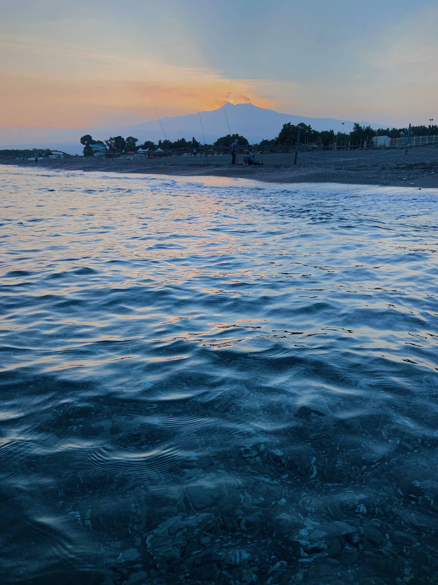
I rented the flat of the mendocina host, the same one from the warning, and let myself stay somewhere off the circuit, at the foot of Taormina. It isn’t a magazine destination. Walking towards the fishmonger waiting with i ricci, the signs spoke to me in Italian and in Cyrillic; the Russians discovered this stretch of coast decades ago, before fashion looked this way. I gained breakfasts and dinners listening to the waves. The beach is long, of black sand: the same sand you slide down running when you trek up Etna. Going out for a jog in the morning and slipping into the sea on the way back. A sea that drops off quickly, only a few steps before you can swim. Fish passing by, the water a deep blue — not the turquoise of postcards but something deeper, transparent all the same — and Etna erupting in the distance.
Etna erupts almost always, and watching it with its explosions while floating on a beach made of its own sand wasn’t a tourist curiosity, but learning what Sicilians have known for centuries: that you can live close.
Favignana
It isn’t quite Sicily. It’s an island apart, off the west coast, an hour by ferry from Trapani. And unlike the others, it isn’t a place to arrive at but to wander through: by bike or by golf cart, from one cove to another, jumping off the rocks into transparent water, going back the next day to the one you liked best. If you’ve travelled European beaches, you probably own a pair of water shoes; mine came from a stall at the port. A detour within the detour.
What would your beach be? The one at the end of the hot trail, the postcard one, the one by Etna, or the ones in Favignana by bike? It says more about you than about Sicily.
Originally published in The Detour on 27 May 2026.